Category Archives: Glasgow and Surrounds

Pollok Country Park, Glasgow

p1080045

p1080053

p1080062

P1020587

Total distance –   3.6 Kilometres

Ascent –  40 metres

Walking conditions – Well-defined footpaths, tracks and tarmac roads. Buggy compatible. No difficulties.

Time required – 1 to 2 hours

Nearest town – Glasgow

Pollok Country Park is the home to the Burrell Collection. So you might think that as the Burrell Collection is closed to the public until 2020, that there’s no point visiting Pollok Country Park. Well think again! It’s a great park with numerous paths and tracks, a great play-park, not to mention Pollok  House. It’s particularly good if you have  very small children with the buggy being the preferred mode of transport. All marked walking routes are buggy compatible and there are three of them. These walks are defined as the yellow route (0.7 miles), the blue route (1.4 miles) and the red route (1.9 miles). As there are a series of tarmac paths and dirt footpaths it’s really entirely up to you to wander about where you like.

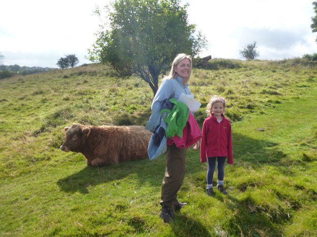
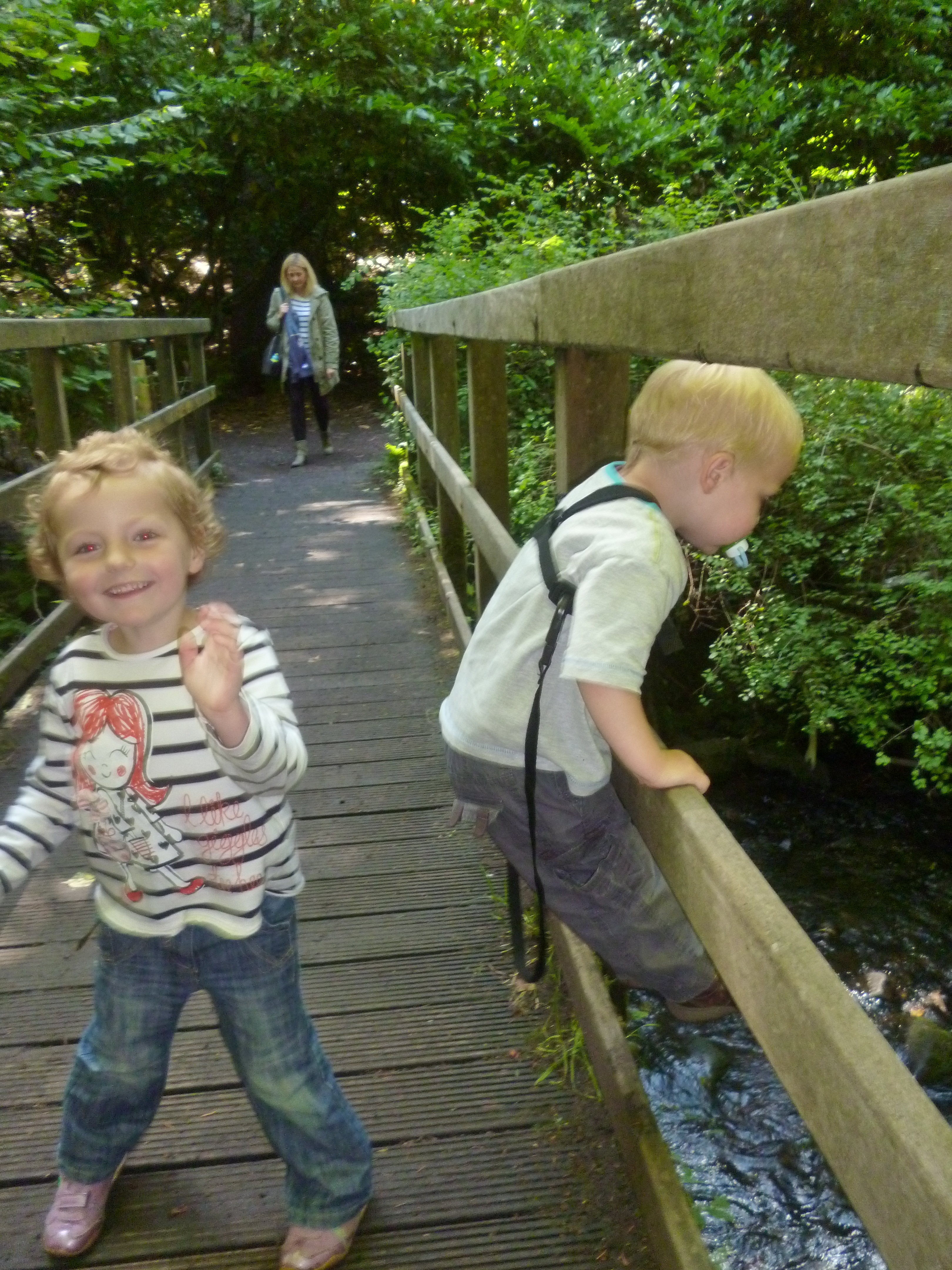
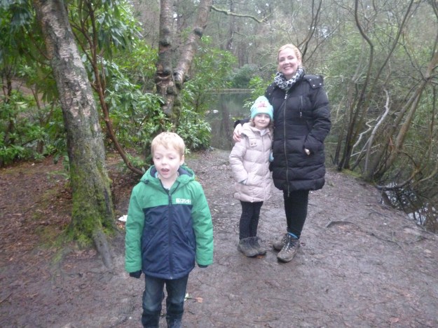
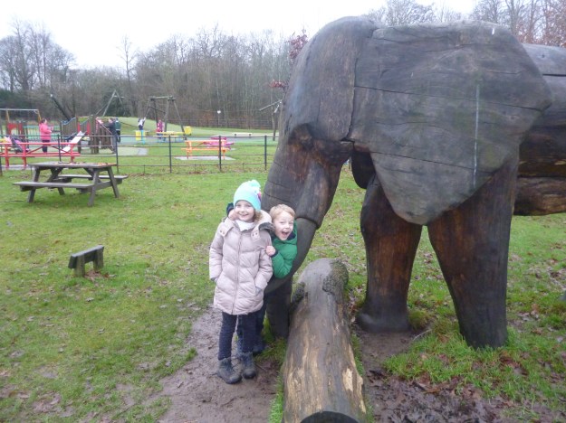
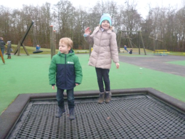
On our particular recent day out we parked in the car park to the rear of Pollok House. We then walked along the tarmac road in a north-westerly direction then pretty much went the way of the red path. We stopped and had our sandwiches in the play-park across from the building that hosts the Burrell Collection. I demonstrated how to use a trampoline to best effect, then we made our way back to the car-park at Pollok House.

pollock


The Antonine Wall, the Auchinstarry Circuit, North Lanarkshire

p1070769p1070783

P1060259

Total distance –10.2 kilometres

Ascent – 220 metres

Walking conditions – Well defined dirt footpath and tarmac cycle path. No difficulties.

Time required – Around 3.5 – 5 hours.

Nearest town – Kilsyth

What have the Romans ever done for us? If you’re a Monty Python fan you’ll know that there’s a long list of things that the Romans have done for us. What wasn’t mentioned in the Life of Brian however, were the numerous great walking routes for outdoor enthusiasts that the Romans built. The Auchinstarry Circuit is just one of them.

Start at the Auchinstarry car park which is just south of Kilsyth. Take a left from the car park and walk for about 200 metres and then turn left onto the Forth and Clyde canal path before the road crosses over the canal. Walk for about two Kilometres along the canal path. Cross the road bridge over the canal and follow the signed footpath up the slope of the hill. Veer right and that will take you up onto the higher ground. If you keep to the highest points along this broad ridge you’ll see signs of the wall together with tourist information. The path then drops down to the north end of Croy and then leads you across the road (the B802). Maintain the same westerly direction and after about one kilometre you’ll come to a very well preserved part of the Antonine Wall which then leads up to the top of Castle Hill. This provides a wonderful view of the surrounding area. The path then takes you on to Barhill Fort, down to Twechar, then a 2.5 Kilometre walk along the canal and straight back to the Auchinstarry car park.

The great thing about stopping at Auchinstarry is that when you’ve finished watching the rock-climbers on the quarry walls you can cross the road and go to the marina and visit the Boathouse for a good feed or some refreshments. The decked area is a fantastic spot and the wasps in attendance are friendly. Well, none of us got stung.

auchinstarry

Rouken Glen Park, East Renfrewshire

P1020030

Total distance – 2.5 kilometres

Ascent – 50 metres

Walking conditions – Tarmac/dirt footpaths. No difficulties. Buggy compatible.

Time required – Around 1 to 2 hours

Nearest Town – Glasgow (South Side)

House prices in East Renfrewshire are notoriously high. Apparently, it’s all down to school catchment areas, but I wonder if Rouken Glen Park has something to do with it. Either way, Rouken Glen Park is still well worth a visit. There’s a brand new pirate themed play area in the middle of the park, so what further incentive do you need? What about an ice cream shop next to a boating pond? Oh, it’s got that as well.


Park in the large car park in front of the garden centre. The path to the left takes you to the wide open section of the park. You’ll immediately see the ‘pirate’ play area. By continuing along the path for a few hundred metres you’ll pass the skatepark on your left and then you’ll reach a small incline that leads to the boating pond. Walk around the pond clockwise, buy an ice cream then take a left. This will lead you to a spectacular waterfall down the White Cart. Cross the waterfall via a bridge, and then immediately take a right onto a delightful footpath which follows the stream and crosses a series of little bridges. This will lead you back to the wide open section of the park. Make your way back to the car park.

Rouken Glen

Route

Mugdock Country Park, Milngavie, East Dunbartonshire

P1040880

P1040888

P1020576

Total distance – 2.9 kilometres

Ascent – 60 metres

Walking conditions – Footpaths and tracks. Can be a little muddy after heavy rainfall. Buggy compatible on dry days. No difficulties.

Time required – Around 1 to 2 hours

Nearest Town – Milngavie

Milngavie is probably best known for being the town that always has its name mis-pronounced. But it’s also famous for being the start of the West Highland Way which is far more exciting. And Mugdock Country Park is directly across the road from the start of the West Highland Way. It’s an expansive park with countless walking routes in addition to playparks, a castle, garden centre,  and second world war installations to name but a few things. A great day out!

For one of our favourite routes, park at the garden centre and make your way south past the courtyard and on to the gravel track. This southerly track quickly veers to the right and you will soon see a large ruin. The track then curves around to the left until you start to walk in an easterly direction. After about 300 metres keep your eyes out for the footpath leading off to the right (you’ll see the castle on the right so you can’t really go too far wrong). This path takes you out over marshy ground. Not to worry though, because you’ll be walking on wooden decking. And after no more than a couple of hundred metres you’re in Mugdock Castle.

To return, follow the footpath back to the track but this time turn right for a couple of hundred metres. Then take the footpath going left. This takes you on a nice loop back to the car park via the Walled Gardens. Visit the café and visitor centre, then let the kids run about the playplay. This should ensure that they’re suitably exhausted and you can guarantee yourself a good night’s sleep.

Mugdock

Route

Cort-ma Law, Campsies, East Dunbartontshire

OLYMPUS DIGITAL CAMERA

P1030828

P1030810

Total distance – 9.0 kilometres

Ascent – 440 metres

Walking conditions – Grassy footpaths with a steady, gentle gradient. Can be boggy in places. No difficulties.

Time required – Around 2.5 to 4 hours

Nearest Town – Lennoxtown

Cort-ma Law was one of the first hills we took the children up. It’s a very popular and busy hill. It’s also busy with sheep, as I’ve learned form past experience. Keeping dogs on the lead would be advisable, otherwise you might have to go up and down the hill twice in one day.

Start from the car park next to the shops at Clachan of Campsie (or if you prefer you can cut a bit off the walk by starting from the  large car park at the Crow Road just up the hill from Lennoxtown). Make your way along the clearly signposted path going northwards for about 500 metres until you reach the car park on the Crow Road. There’s often an ice cream van here during the summer so it’s a great morale booster. From there, cross the road then make your way up the broad grassy shoulder going east. The ascent of Cort-ma Law is fairly relentless but the gradient eases off as you reach the high ground which is more or less a plateau. You will immediately notice the fantastic views over the Clyde Valley and beyond, and now it’s just a matter of continuing along for a couple of kilometres until you reach the summit of Cort-ma Law.  The summit’s even got a trig point! It can however, be quite a long walk for the very young. As such, there have been times when we have turned back at one of the little high points marked with cairns along the way. Either way, it’s an excellent high level walk along the top of the Campsies. Return via the same route.

Cort-ma Law

Route

Queen’s Park, Glasgow

P1040576

Total distance – 3.2 kilometres

Ascent – 60 metres

Walking conditions – Nearly all tarmac paths. No difficulties. Buggy compatible.

Time required – Around 1 to 2 hours

If you thought that the abundance of squirrels was the only reason to visit Queen’s Park you couldn’t be more wrong. Apart from being in the ‘trendy’ part of Glasgow’s South Side, Queen’s Park has a number of attractions including a glasshouse featuring the Zen Garden, ponds, tropical fish, exotic birds and an excellent reptile house. There’s even a small soft play area for the under 5s. And it’s all free! There is also much to keep you occupied on your way around the park.

Make your start/ finish point the Queen’s Park Glasshouse. From the Glasshouse exit right. After a few metres take another right leading onto a dirt footpath that takes you along the rear of the Glasshouse. After about 400 metres you will come out at the Queen’s Park Flagpole which is the highest and best viewpoint in Glasgow City. When you make your way down form there you’re pretty much just circum-navigating the park. Try to ensure that you visit the play-parks, nature pond and rose gardens. And don’t forget to keep your eyes peeled for squirrels!

Queen's Park

Route

Glasgow Green to Buchanan Street, Glasgow

P1000707

Great Scottish Run/ Toddler Dash at George Square

Total distance – 5.2 kilometres

Ascent –  30 metres

Walking conditions – Entirely roads, pavements and good paths. No difficulties.

Time required – Approximately 2 hour’s walking time plus however long you wish spend at the numerous attractions

Glaswegians like a long lie at the weekend; apart from those who haven’t been to bed yet. This provides the fantastic opportunity of going for a morning walk around some of the Scotland’s busiest and most interesting streets whilst it’s still quiet.

Park at Templeton Street on Glasgow Green. Walk along this road and you will quickly reach the Doulton Fountain, which is the world’s largest Terracotta fountain and lies next to the People’s Palace. The People’s Palace is also a great tourist attraction. Apart from the museum (free entry) which charts the history of Glasgow there is a magnificent large glasshouse at the back which is home to a delightful café and features a variety of trees and shrubbery and leads out into beautiful gardens. From there, walk to the other side of Glasgow Green and cross the road at the High Court. Follow the path next to the Clyde for a few hundred metres then turn right just past the St. Enoch’s Centre. This will take you directly to the pedestrianized zone of Buchanan Street which my wife reliably informs me is one of Europe’s great retail centres. Walk as far as the Buchanan Galleries then walk down to George Square. There is always something going here including any manner of street performers and organised displays.

By now you will probably experience the dilemma of choosing somewhere to go for lunch. If you walk from George Square down Queen Street you will find a number of well-reputed places to eat at Royal Exchange Square. Then make your way back to Glasgow Green via Argyll Street.

There are some really good play-parks in Glasgow Green particularly the one on Templeton Street which should be close to where you’ve parked.

Glasgow Green

Route

Cathkin Braes, Glasgow

P1030853

Commonwealth Games at Cathkin Braes

P1070058

P1070050

P1040270

Total distance – 4.2 kilometres

Ascent – 60 metres

Walking conditions – Easy walking on good footpaths. Fairly flat. No difficulties.

Time required – Around 1.5 to 2.5 hours

Nearest town – Glasgow/ East Kilbride

Cathkin Braes is undoubtedly the best location to view Glasgow from the south. It is now home to one of the UK’s best mountain biking trails and was the setting for the Commonwealth Games mountain bike competition. It is also proof that walkers and mountain-bikers can co-exist without conflict. The vast network of tracks and paths within Cathkin Braes ensures that even on a busy day we tend not to get in each other’s way. What’s ideal about Cathkin Braes for us is that it is within easy walking distance from our house and if the children are misbehaving we can speed-march them up the hill or the bad fox will catch them.

The start of this walk is from the large car park on Cathkin Road which is a few hundred metres up the hill from Carmunnock (Glasgow’s only village). Head west across the fairly flat, open ground. After about 800 metres this leads to a viewpoint at the edge of the tree line over-looking Carmunnock and you can see as far as Arran. Then change to a north easterly direction until you enter the forest. Take one of the many tracks going east. It’s probably best to stay near to the tree line that you entered from. After about a kilometre you should come into open ground. You’ll see a building with a huge mast. Beside it is a trig point (we love trig points). This is a fantastic place to stop for a picnic as you can see the whole of Glasgow, the Campsies, Ben Lomond and beyond. From there walk over to the stone circle feature which is clearly visible form the trig point. To get back to the car follow any of the paths through the trees which run parallel to Cathkin Road.

A visit to Carmunnock is to be recommended. We’ve had great days out there at the Carmunnock Highland Games and we’ve often stopped at Mitchell’s for dinner and to look at the fish tank.

Cathkin Braes

Route

Glasgow’s West End

P1040297

p1040291

Total distance – 4 kilometres

Ascent – 30 metres

Walking conditions – Entirely roads and pavements

Time required – Approximately 1.5 hour’s walking time plus however long you wish spend at the numerous attractions

The west end of Glasgow was my happy hunting ground in my years as a student at Glasgow University. It is also a fantastic urban adventure for the children as there’s loads to do. We’ve carried out a number of incursions into the West End and on our most recent mission we identified three key objectives.

The Botanic Gardens is your first port of call so find a parking space close by. If you are in a metered zone make sure you buy a parking ticket. The parking attendants do not mess about here. The gardens are open all year round (free entry) and there are 19.6 hectares to wander around in. These gardens extend to the river Kelvin walkway. The Glasshouse (Kibble Palace) and Tearooms are also worth a visit and are open during the day.

From the Botanic Gardens head along Byres Road. Take a left at Dumbarton Road. By all means stop for lunch at one of the cafes along the route. After about 300 metres you will see the magnificent Kelvingrove Art Gallery on the left hand side. When you enter, despite what may appear to be the case the Kelvingrove Art Gallery is in fact not a crèche with loads of things to climb onto, but a museum which is free to visit and show-cases numerous invaluable works of art. Make sure you scare the children by visiting the dinosaurs.

The final objective is Kelvingrove Park which is right beside the Kelvingrove Art Gallery. It’s a great park with extensive grounds and for the children there is a skatepark and a playpark beside each other. I could now reminisce about the original skatepark which had been filled in during the 1980s and has made up some of my fondest childhood memories, but that would be self-indulgent. Anyway, when you’re done, walk along Kelvin Way and take a left at Universtiy Avenue which leads you back to Byres Road.

Glasgow's West End

Route


Dumgoyne, Campsies, Stirlingshire

DSC_0274

P1070661

OLYMPUS DIGITAL CAMERA

Total distance – 4 kilometres

Ascent – 430 metres

Walking conditions – Good footpath up grassy slope. However, the slope is relentless and particularly steep in places. Children may require assistance descending the steepest sections.

Time required – Around 2.5 to 4 hours

Nearest town – Strathblane

This is the favourite hill of many a rambler, including my mum who is always guaranteed to point out Dumgoyne to anyone and everyone at any given opportunity. It wouldn’t be so bad but you can see it clearly from almost anywhere in her home town of Blantyre. Being part of the Campsie Fells, Dumgoyne sets itself apart and not just literally.


From the parking bay at Dumgoyne Distillery cross the road and follow the faint path over fields until you cross a stream beside a fence. At this point the route becomes a distinct footpath which leads directly up an increasingly steep slope straight to the top of Dumgoyne. The path is wide in places as a result of the large number of visitors who are probably avoiding the muddier parts of the path by going around the sides. Please try to avoid doing this as it causes considerable erosion. Although it’s hard work, before you know it you’ll be on the summit. Park yourself close to the trig point, get your sandwiches out, and strike up a conversation with whoever it is you will be sitting near to on this busy, extremely enjoyable and most sociable of hills.


Take care on the way down as it is particularly steep (although not dangerous) and should be avoided if there are not enough confident adults to ensure the children can get down without any dramas. Alternatively, take a leaf out of my wife’s book and slide down the steep slope on your backside. The children are guaranteed to do likewise.

Dumgoyne

Route