Monthly Archives: April 2015

Neptune’s Staircase, Banavie, Lochaber

P1050158

p1050157

P1050230

P1050241

Total distance – 4.7 kilometres

Ascent – 30 metres

Walking conditions – Mainly tarmac footpath. Buggy compatible. No difficulties.

Time required – Around 1.5 to 2.5 hours.

Nearest town – Fort William

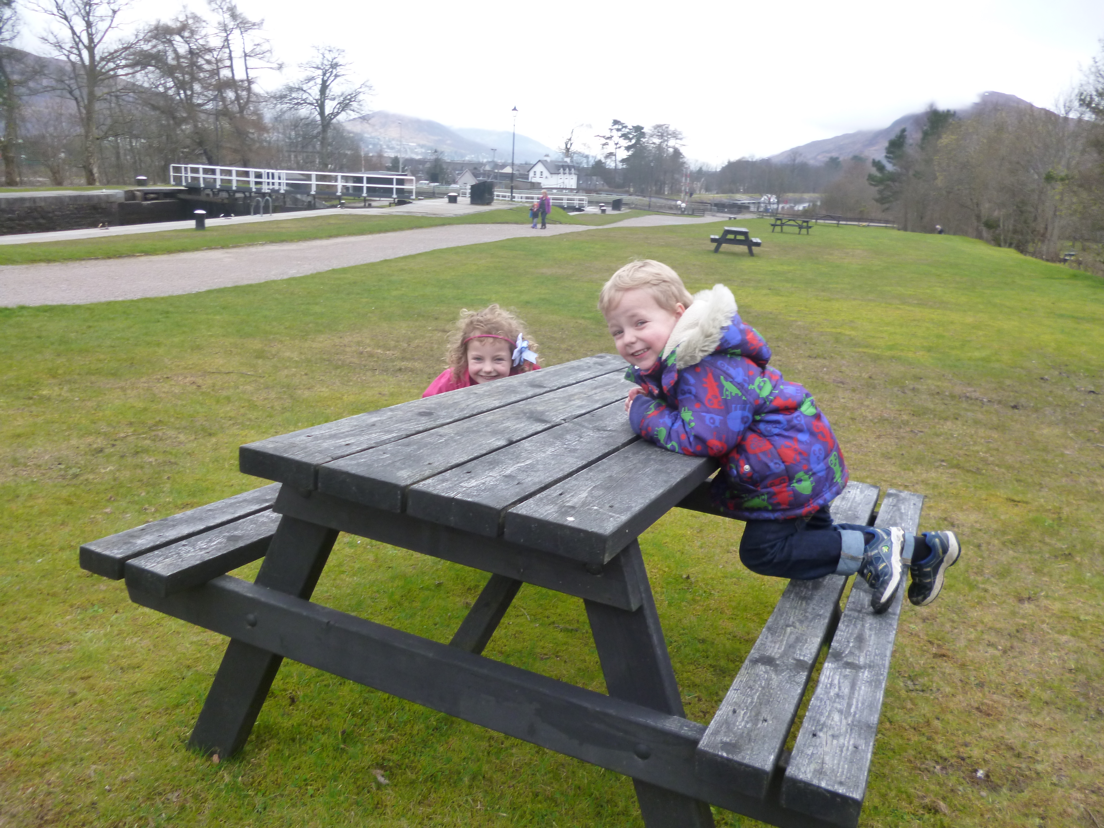
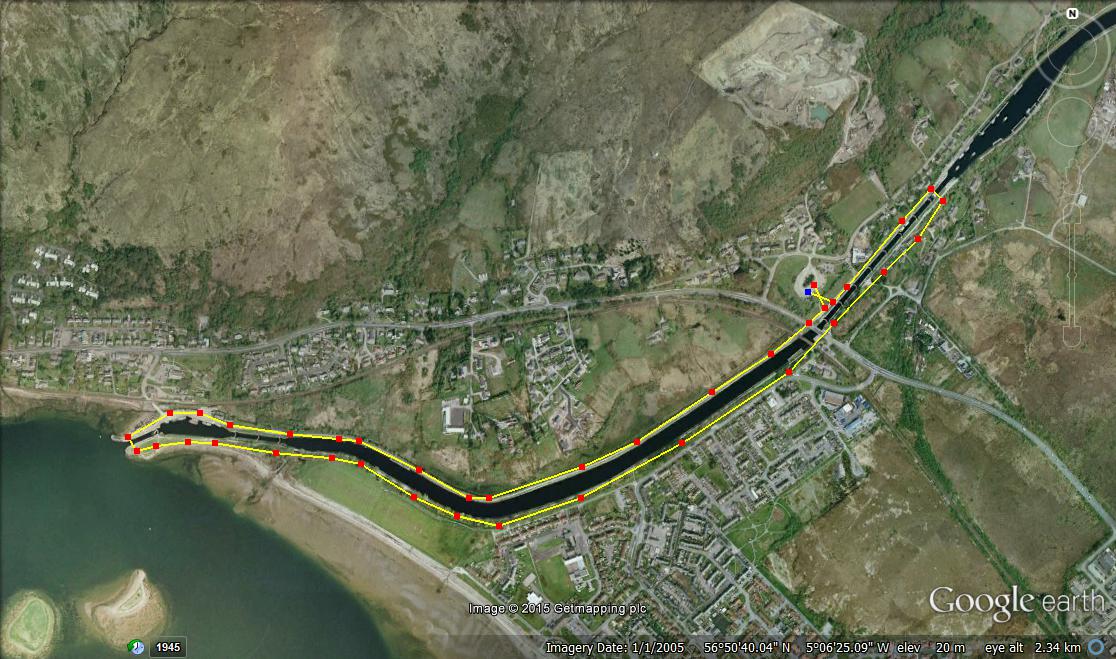
In a bid to impress my wife I splashed out on a two night’s dinner, bed and breakfast deal at the 4 star Moorings Hotel in Banavie, near Fort William. The amount of freebies on offer such as the range of biscuits in this 4-star paradise more than warranted the extra cost. But an added bonus was that the Moorings Hotel was right next to the Thomas Telford designed, Neptune’s Staircase. This engineering masterpiece just happens to be set in one of Scotland’s greatest landscapes, and can be taken in with a very enjoyable walk along the Caledonian Canal to Loch Linnhe.

Park in  the large public car park in Banavie, adject to the Moorings Hotel and walk a few metres to the Caledonian Canal, then turn right.Follow the canal across the road and over the level crossing followed by a 1.6 kilometre easy stroll along the banks of the canal until it meets Loch Linnhe. Cross over at the final sea-loch and you’ll find a delightful picnic area to stop to have your lunch at. The ducks will have already been pursuing you along the canal and are expecting to be fed, so make sure you’ve got some extra bread. Then it’s simply a case of walking back up the other side of the canal.  Keep going until you’ve got to the last footbridge, then turn left and walk back down to the car park. And don’t leave until you see a boat crossing the staircase because it’s a sight to behold.

Neptune's Staircase

Route

St. Andrew’s to the Rock and Spindle, Fife

P1050389

p1050418

P1050341

Total distance – 9.0 kilometres

Ascent – 90 metres

Walking conditions – Pavements, footpaths and tracks. No difficulties.

Time required – Around 2.5 to 4 hours.

St. Andrew’s is a magnet for royalty, the privileged and geology enthusiasts. That’s right, there are some fantastic rock formations along its coastline, so much so that even Prince William was lured to St. Andrew’s University to study. It makes for a fantastic walk even if your knowledge of geology is limited.

Try to get a parking space in or near the town centre (unfortunately many of the parking pay and display spaces have a two-hour maximum stay, so it’s probably best going fairly early in the morning). Make your way through the very distinctive arch over the road as you turn right at North Street with St. Andrew’s Cathedral on the left . This will lead you down to the harbour. It’s lovely here with fishing boats, a little ram-shackle, but quaint café, and a play park. It’s then just a matter of walking along the footpath which forms part of the 186 kilometre Fife Coastal Path.

The walk really gets going at the end of the tarmac path next to the caravan site. If you keep on walking you will soon see a 10 metre blade of rock next to the shore called ‘Maiden’s Rock’. It’s a great place to stop for a break and there’s a little dirt path leading down to it. Going back up to the main path you;ve then got the decision whether you want to take the lower path or the slightly higher path. Either way, they both skirt along the coastline and meet after a few hundred metres. Soon after that you’ll cross over a stile with the Fairmont Golf Course on the right. The path then drops right down to the shoreline . After 300m the coastline changes direction by around 90 degrees and within another few hundred metres you’ll see three large sea stacks. The Rock and Spindle is the largest and most spectacular of them. Have a picnic and a chat with any other visitors, but remember to either courtesy or exclaim ‘Viva la revolution!’, whichever you deem most suitable. If the person is sporting a beard and wearing a woolly jumper, just ask about fragmented basalt. Return via the same route but take time to go to the cathedral and wander about the town.

St. Andrew's

Route

Port nam Murrach, Arisaig

P1050194


p1050206

p1050198

Total distance – 4.6 kilometres

Ascent – 80 metres

Walking conditions – Mainly tarmac road and track. The stretch along the footpath can be quite muddy in places, particularly after heavy rain. No difficulties.

Time required – Around 2 to 3.5 hours.

Nearest town – Mallaig

Travelling on the A830 from Fort William to Mallaig is perhaps one of the most magnificent stretches of road in Scotland. Seven miles shy of Mallaig lies the picture postcard village of Arisaig. This is a place my wife has been raving about for years on account of a family holiday where she stayed there as a child. Nostalgia is not necessary for being blown away by the walk from Arisaig to Port na Murrach. Indeed, any moans or complaints about the walk being a little muddy in places, cease to be heard the minute you walk onto the beach.

From Arisaig, drive along the single track road signposted ‘Rhu’ to the parking spot at the end of the public road. From there walk along the private road/track for about 1.4 kilometres. At that point you will reach a private house with a sign pointing to the footpath on the left. This footpath leads past a hut and along a stone dyke. Due to the movement of livestock this can be particularly muddy. It only lasts for about one hundred metres then the going gets easier, although still muddy in places. Keep following this path until you drop down a rocky outcrop onto one of the most idyllic and picturesque beaches you are ever likely to see, with golden sand transported here from Mexico by the Gulf Stream. Make sure you have brought a map so you can identify all the islands and rock features which you see before you. Return via the same route. Oh, and if you go on a Sunday make sure you’ve got enough petrol because it’s a long way back to Fort William.

Arisaig

Route

Signal Rock, Glencoe

P1050132

P1050129P1050124

p1050150

Total distance – 2.2 kilometres

Ascent – 80 metres

Walking conditions – Generally good footpath but can be muddy in places, particularly after heavy rain. No difficulties.

Time required – Around 1 to 1.5 hours.

Nearest town – Ballachulish

The Glen Coe Massacre was the scene of one of the most shameful and notorious nights in Scottish history. The torch that was lit by the Campbell’s to signal the start of the slaughter was positioned just to the rear where the Clachaig Inn now stands, so the story goes. The Clachaig Inn is also the location of a number of shameful, notorious but thoroughly entertaining nights. However, my most recent visit to the Clachaig Inn did not involve staggering in the pitch black back to the Red Squirrel campsite. Instead, it involved a short but enjoyable circuit around the Clachaig Inn, followed by a very reserved visit to the lounge, and then some time for the kids to play in the little park. Oh well!

Park close to the Clachaig Inn. (The Clachaig Inn is easily identifiable as there will be groups of people in the car park all wearing Gortex and pointing upwards towards the Aonach Eagach ridge). At the left hand edge of the car park follow the red gravel footpath. After about 400 metres you will reach the footbridge over the River Coe. This footbridge leads only to a car park next to the A82 and is not part of the route but its a fantastic spot and well worth stopping for. Anyway, the footpath goes to the right and ascends into the forest. Keep following the path for another few hundred metres and after a very short climb you will be at Signal Rock. Return via the same path for about 50 metres then take the footpath on the left. Although quite muddy in places this path will soon take you to a better track next to a small lochan on your left hand side then quickly leads you on to the road. Take a right when you get to the road and return to the Clachaig via the new ‘Orbital’ footpath which skirts this road. This is possibly, the best place to start and finish a walk that I can think of.

Signal Rock